Morning sun on the plateau. Photo: Jacque Comery
|
Showing posts with label Plateau. Show all posts
Sunday, 23 August 2015
Wednesday, 5 August 2015
July 19: Leaving Brother's Point, headed to Station
After a lovely last night, of listening to the wind whistle around the hut, I decided to make an early break for Station, to try and get up and over the plateau before mid morning winds were expected to build to around 40 kts (50 kts up on top).
I set off at around 0700hrs, in the very early dawn light and snow. The walk in flat light was pretty, and the snow got deeper as I walked, with some of the drifts getting up around mid-thigh depth at times. The fog closed on just as I got to the last part of my walk, making navigation a challenge, especially as most of the track markers were blown over! A fun surprise was finding penguin footprints up the track almost all the wat up to the plateau. How (and why) those little guys waddle all that way in snow up steep hills on their little short legs is a mystery to me.
A wonderful 3 day solo trip, exploring this beautiful and wild place.
I set off at around 0700hrs, in the very early dawn light and snow. The walk in flat light was pretty, and the snow got deeper as I walked, with some of the drifts getting up around mid-thigh depth at times. The fog closed on just as I got to the last part of my walk, making navigation a challenge, especially as most of the track markers were blown over! A fun surprise was finding penguin footprints up the track almost all the wat up to the plateau. How (and why) those little guys waddle all that way in snow up steep hills on their little short legs is a mystery to me.
A wonderful 3 day solo trip, exploring this beautiful and wild place.
The RAPS unit at sunrise, with The Nuggets in the rear. Photo: Jacque Comery
|
A snow flurry on the beach, as I am leaving the hut. Photo: Jacque Comery
|
Giant Petrel footprints in the snow. Photo: Jacque Comery
|
Sandy Bay Track looking back to Sandy Bay. Photo: Jacque Comery
|
Sandy Bay track looking up towards 4-Ways track junction. Photo: Jacque Comery
|
Snow drifts hiding the track markers. Photo: Jacque Comery
|
| On the trail home. Photo: Jacque Comery |
Sunday, 5 July 2015
July 1: Marine debris survey at Bauer Bay
This morning I headed out with Ranger-in-Charge, Andrea Turbett to Bauer Bay on the west coast to assist with the monthly Marine Debris Survey. The route to Bauer Bay takes us up onto the Plateau via the Doctors Track and then over onto the Island Lake Track (the ILT), a fast and easily navigable route, to drop down into Bauer Bay. The lakes were frozen, and the entire landscape was a picturesque blending of shades of grey. We danced over the icy track, and arrived at the hut around lunchtime. After dropping our packs at the hut and taking on board some hot blackcurrant juice,(known here as BCJ), we hit the beach, buckets in hand.
We were most excited to see what had washed ashore in the big seas. As well as loads of kelp our haul included approximately 10 plastic bottles, 60 pieces of hard plastic, 40 bits of rope, and 165 pieces of 'green string'.
The green string has been washing ashore at Macquarie Island and a number of other sub-Antarctic islands, and is thought to be used in long line fishing for Patagonian Toothfish.
One exciting find was a fine piece of plastic which carried text with a please return if found instruction. The return address was NIWA in New Zealand.
We searched until dark only covering a small portion of the beach, such was the amount of debris. We counted weighed and photographed our load. Pre-dinner conversation was dominated by brainstorming what NIWA was and who would possibly expect such a small piece of plastic to be found, let alone returned!
We are such a small speck in the remote southern ocean, and yet still plastic lands upon our shores everyday.
After cooking a dinner of pasta and butterscotch pudding, and completing our nightly Sched with VJM (the Station), we settled in for the night, happy with our efforts.
We were most excited to see what had washed ashore in the big seas. As well as loads of kelp our haul included approximately 10 plastic bottles, 60 pieces of hard plastic, 40 bits of rope, and 165 pieces of 'green string'.
The green string has been washing ashore at Macquarie Island and a number of other sub-Antarctic islands, and is thought to be used in long line fishing for Patagonian Toothfish.
One exciting find was a fine piece of plastic which carried text with a please return if found instruction. The return address was NIWA in New Zealand.
We searched until dark only covering a small portion of the beach, such was the amount of debris. We counted weighed and photographed our load. Pre-dinner conversation was dominated by brainstorming what NIWA was and who would possibly expect such a small piece of plastic to be found, let alone returned!
We are such a small speck in the remote southern ocean, and yet still plastic lands upon our shores everyday.
After cooking a dinner of pasta and butterscotch pudding, and completing our nightly Sched with VJM (the Station), we settled in for the night, happy with our efforts.
Blue hard plastics collected at Bauer Bay. Photo: Jacque Comery
|
Frozen shore of Island Lake. Photo: Jacque Comery
|
Island Lake. Photo: Jacque Comery
|
Icicles at Island Lake. Photo: Jacque Comery
|
Jacque at Island Lake. Photo: Andrea Turbett
|
Green String! Photo: Jacque Comery
|
| Collecting marine debris. Photo: Andrea Turbett |
NIWA tag. Photo: Andrea Turbett
|
Hard Plastic haul. Photo: Jacque Comery
|
Green hard plastics. Photo: Jacque Comery
|
Caps and Lids. Photo: Jacque Comery
|
Sunday, 14 June 2015
June 9: Sunrise at North Head
The sun is hanging so low in the sky now that we have sunrise, and then sunarrive! Sun finally makes it to Station at around 10am ish. The Station is tucked in behind North Head down on the Isthmus. So even after the sunrises, it takes a while to finally peek out from behind the peninsula and cast it's rays upon us.
On this morning I stood up on the 'golf tee' on the Wireless Hill track with Chef Justin to capture the sun lighting up the plateau. Clear blue skies such are still a rarity.
First rays of sun light up the King Penguin rookery at Gadgets Gully. Photo: Jacque Comery
|
After the sun finally peeks around North Head it shines bright upon the north-west edge of the plateau. Photo: Jacque Comery
|
The first Station buildings get the sun. Photo: Jacque Comery
|
Good morning Macca. Photo: Jacque Comery
|
Tern Rock to the east. Photo: Jacque Comery
|
Sunday, 7 June 2015
June 2: Trip to to Green Gorge - Day 1
Having not yet explored further south than Brother's Point, a three day trip down to Green Gorge was planned. Louise, Bureau of Meteorology Observer also had time off and joined me on the adventure.
We set out in fine but cold weather leaving Station (call sign VJM) at around 0830hrs.
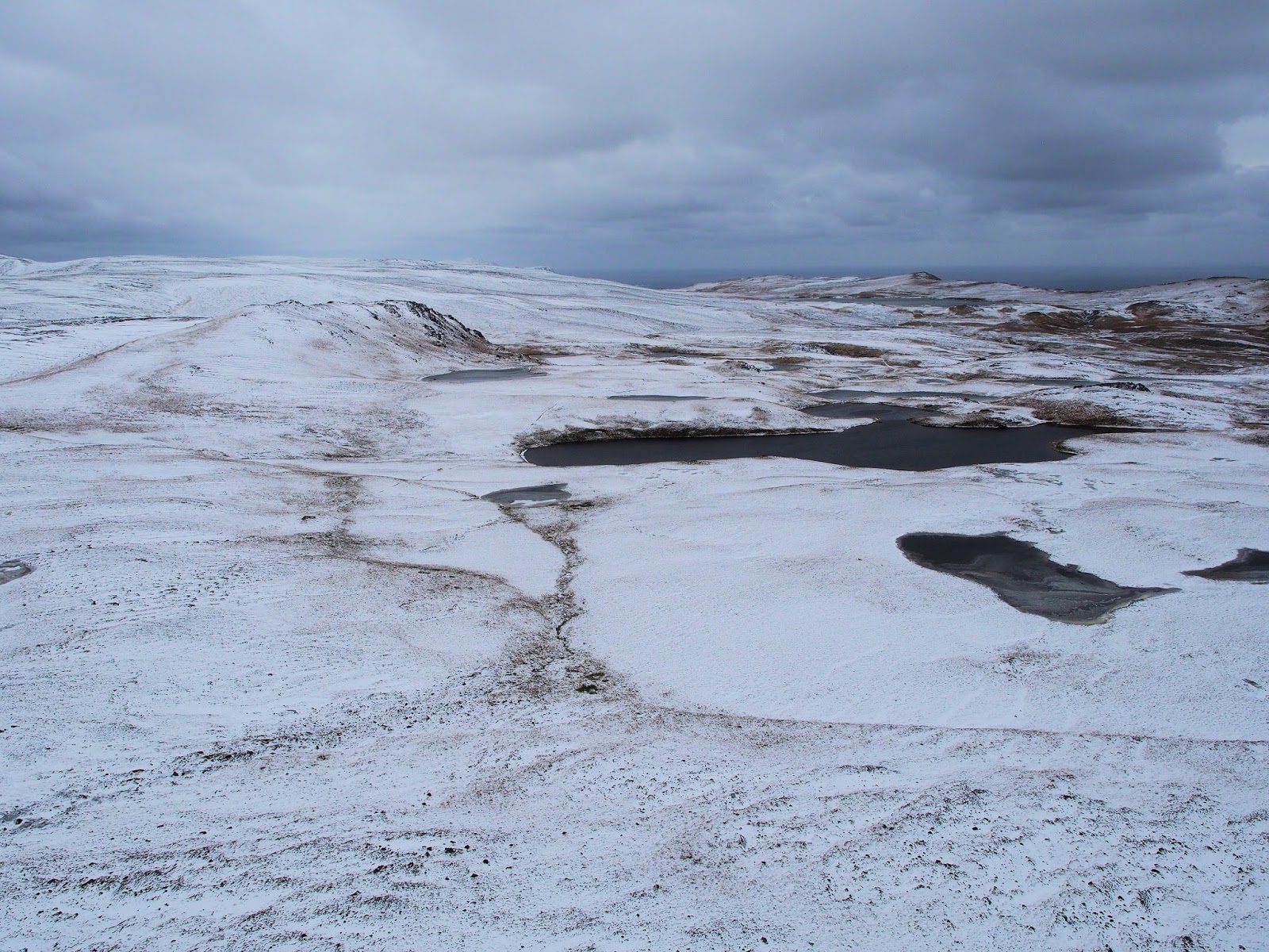
The snow at the top of the Doctors Track, which jumps you up from VJM to the Plateau started to build. What at first presented as a pretty photo opportunity soon became a little treacherous as we navigated elevated boardwalk sections of the Overland Track (the OLT) all buried in snow up to our knees! The cold kept the photo opportunities limited as I was trying to preserve my fingers, but we were stunned by the beauty and the colours that glow from the landscape when the sun breaks through the clouds to light it up.
This part of the plateau is lashed by winds usually 10 knots higher than down on Station. The only things that grow up here are mosses and some other tenacious plants such as Azorella macquariensis. To give you an idea of the conditions here, another known species of Azorella grows in the Andes!
After a 6 hour walk we finally reached Green Gorge, tired and ready for cups of hot tea. I was fuelled on the walk by about 6 pieces of my leftover birthday cake!
![]() |
Frozen lakes from the Overland Track. Photo: Jacque Comery
|
![]() |
Farewell VJM. Photo: Jacque Comery
|
![]() |
Crepuscular clouds looking back over North Head. Photo: Jacque Comery
|
![]() |
Moss. Photo: Jacque Comery
|
Having not yet explored further south than Brother's Point, a three day trip down to Green Gorge was planned. Louise, Bureau of Meteorology Observer also had time off and joined me on the adventure.
We set out in fine but cold weather leaving Station (call sign VJM) at around 0830hrs.
The snow at the top of the Doctors Track, which jumps you up from VJM to the Plateau started to build. What at first presented as a pretty photo opportunity soon became a little treacherous as we navigated elevated boardwalk sections of the Overland Track (the OLT) all buried in snow up to our knees! The cold kept the photo opportunities limited as I was trying to preserve my fingers, but we were stunned by the beauty and the colours that glow from the landscape when the sun breaks through the clouds to light it up.
This part of the plateau is lashed by winds usually 10 knots higher than down on Station. The only things that grow up here are mosses and some other tenacious plants such as Azorella macquariensis. To give you an idea of the conditions here, another known species of Azorella grows in the Andes!
After a 6 hour walk we finally reached Green Gorge, tired and ready for cups of hot tea. I was fuelled on the walk by about 6 pieces of my leftover birthday cake!
Friday, 8 May 2015
April 26: The Island Lake Track
My first trip on foot over the plateau to Bauer Bay with Rangers Andrea and Anna. The terrain up here is so windblown that only the smallest most rugged plants can grow.
| Andrea and Jacque on the Island Lake Track. Photo: Anna Lashko |
Sunday, 3 May 2015
April 15: Macquarie Island from the air
![]() |
Major Lake with Sandell Bay in foreground. Photo: Jacque Comery
|
![]() |
Southern featherbed with Aurora Point to south. Photo: Jacque Comery
|
![]() |
Eitel Search and Rescue (SAR) cache beside lake. Photo: Jacque Comery
|
![]() |
Mt Waite between Sellick Bay and Double Point facing east. Photo: Jacque Comery
|
![]() |
The Nuggets, looking up Nuggets Creek and Rookery Creek. Photo: Jacque Comery
|
![]() |
Green Gorge Hut and King Penguin colony. Photo: Jacque Comery
|
![]() |
Lusitania Bay, home to thousands of King Penguins. Photo: Jacque Comery
|
![]() |
Mt Aurora looking north. Photo: Jacque Comery
|
![]() |
Scoble Lake looking towards Boot Hill ( looking South east).Photo: Jacque Comery
|
![]() |
Overland track looking south. Photo: Jacque Comery
|
![]() |
Looking south from North Head over our home on the Isthmus. Photo: Jacque Comery
|
![]() |
'Macca' Macquarie Island ANARE Station. Photo: Jacque Comery
|
![]() |
About to touch down on the heli pads on the Isthmus. Photo: Jacque Comery
|
Wednesday, 29 April 2015
April 12: View from Doctors Track
View from the plateau above the Station. L-R Andy, Stu, Mad, Tim, Me and Ben. Photo: Ivor Harris
|
Subscribe to:
Posts (Atom)